Qlik GeoAnalytics
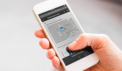
Geospatial visualization and analytics
GeoAnalytics not only provides comprehensive mapping capabilities but also moves beyond visualizations with built-in spatial analysis support for a broad range of advanced geoanalytic use cases to help reveal crucial geospatial information and expose hiddgen geographic relationships.
Powerful map visualizations & location-based analytics for both Qlik Sense and QlikView

High performance, Interactive mapping
Easily create maps using automatic geo-data lookup and then overlay them with different visualizations
Be more productive with on-the-fly location lookup capabilities
Improve understanding by exploring all geo information along with any relationships within one map visualization

Gain geospatial insights with visualizations
Go beyond map visualizations to understand and analyze geospatial relationships
Efficiently access, visualize and analyze any existing geospatial related data and applications
Gain insight into patterns not easily interpreted through tables or charts
Broad location-related use cases
Deliver mapping and location-based analytics to every user throughout the organization
Share a common set of tools with a full spectrum of mapping and geospatial capabilities
Provide credibility and domain expertise to a customer's geospatial engagement
Learn more about Qlik GeoAnalytics
What is spatial analysis?
GeoAnalytics Data Sheet
Explore this in-depth guide to spatial analytics strategies
Learn more about Qlik GeoAnalytics advanced mapping and location-based analytic capabilities